THE ROAD TO CHIMBORAZO – FIRST STOP RUMIÑAHUI
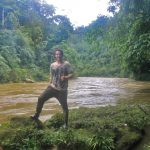
NILS
Come with me to THE ROAD TO CHIMBORAZO – FIRST STOP RUMIÑAHUI.
A couple of weeks ago, a friend and I decided that we wanted to attempt climbing Ecuador’s highest mountain, Chimborazo. With an altitude of 6268 meters above sea level this mountain is an actual giant. Therefore, it was clear from the beginning that prior preparation is needed. For that reason we planned to climb at least one volcano the 3 weeks prior to our desired ascent to Chimborazo. This volcanoes are namely Rumiñahui (4631m), Imbabura (4630m) and Iliniza Norte (5126m).
So let’s begin!
Last weekend my friend and I took the early morning bus towards Latacunga. After about 1.5 hours driving we jumped of the bus close to the entrance to Cotopaxi National Park. We hired a driver to take us to the Tombopaxi Lodge, where we would spend the night. Our plan was to drop our stuff in the room and then make our way to the parking lot on the slopes of the Cotopaxi Volcano to start hiking up to the refuge at around 4900 meters.
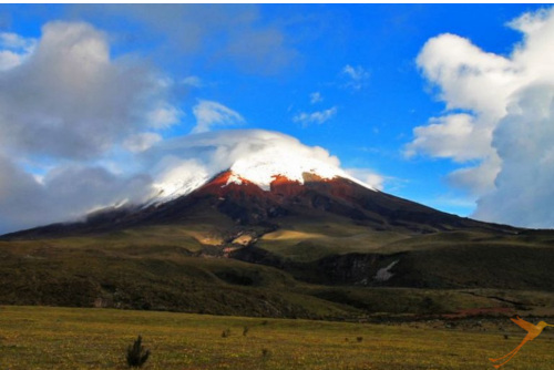
By the time we started hiking, the part of the mountain we were on was covered in clouds. The wind struck hard from the left side and the rain did not make the hike up really comfortable. After 30 – 40 minutes we already reached the refuge, we went inside and had a soup and coca tea. After that we decided to walk all the way back to our lodge which meant that we made our own way down the slopes of Ecuador’s second highest volcano. It took us about 2.5 hours to walk down Cotopaxi while enjoying picterous views over the National Park’s landscape. From the foot of the mountain it was another 5-6 km walk to our accommodation where we arrived at sunset.
At that point there was not much more to do but have a proper dinner, a deserved cold beer and to regenerate for the hike on the next day.
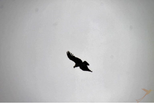
In the morning we got up at around 8 and started our hike towards the Rumiñahui volcano. We started walking through the high grass and over the hills towards the mountains. On our way, we were lucky enough to have a glimpse at a large condor soaring over our heads.
The clouds where hanging deep and we were not quite sure if it would be possible to do the ascent all the way to the top since we did not have a guide with us. However, we turned out to be lucky since shortly before we reached the foot of the mountain it cleared up and we felt confident enough to try our luck. By that time we were about three hours into the hike but the hardest part was definitely yet to come.
After a short break in the sun, we started the final ascent to the summit on an altitude of 4631m above sea level. The ground was quite soft which made the way up quite challenging, in combination with the altitude of course. However, the magnificent views over the lush green fields, Laguna and towards Cotopaxi definitely made up for it. It was another 1.5 hours until we reached the summit and the view was incredible.
We enjoyed the views for a while but due to a little time pressure and the temperatures on top we started descending after about 20 minutes.

The descend took another 2-3 hours since we lost track of the way and just walked down through the high grass and bushes to the Laguna. By the time we reached the Laguna I was happy to be at the bottom because my legs were drained of all their energy. From there we hitched a hike back to the Panamerican highway, from where we made our way back to Quito.
Looking back at the trip, I can honestly say that it was quite challenging. However, I think I haven’t reached my limit yet, so I am confident for the upcoming hikes. So that’s it for now. Next Stop, Imbabura!
visit our other channels
Recent Posts
- From Manglaralto to Pacoche and surroundings April 18, 2024
- Excursions within the rainforest region of Ecuador April 5, 2024
- Ecuador in a state of emergency?! My personal experience March 22, 2024
- The 10 most beautiful lakes and lagoons in Ecuador – Part 2 March 12, 2024
- The 10 most beautiful lakes and lagoons in Ecuador – Part 1 February 23, 2024